- AIS-visible vessel crossings fell to just 16 in the third week of conflict, down from a normal average of 77 daily.
- ‘Dark’ activity (ships switching off AIS) surged to 427 events in a day, with GPS interference affecting over 1,100 vessels.
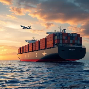
- Oil exports continue via alternative routes like the 1,200 km Petroline pipeline and increased traffic around the Cape of Good Hope.
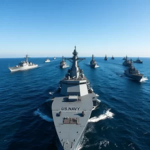
Four weeks into the conflict with Iran, maritime traffic through the Strait of Hormuz has not halted but transformed radically. Shipping companies and navies are navigating a new reality where visible crossings plummeted by 80% in 24 hours. This shift is driven by security concerns, leading vessels to conceal movements and adapt to electronic warfare, while global oil flows persist through diverted channels.
CONTEXT AND BACKGROUND
The Strait of Hormuz is a critical global maritime chokepoint. It handles about 20% of global oil, equivalent to 20 million barrels daily. Historically, disruptions here have spiked energy prices and forced logistical adjustments, as seen in past regional crises.
Under normal conditions, navigation is open and predictable. However, the current escalation has altered this pattern. While traffic has been affected before, the magnitude—an 80% drop in visible crossings—is unprecedented in decades, marking an operational inflection point.
IN-DEPTH TECHNICAL ANALYSIS
The decline in AIS-visible traffic does not mean inactivity but a migration to ‘dark’ navigation. Vessels are switching off their AIS transponders (Automatic Identification System, transmitting position and identity) to hide movements, with 427 events recorded in one day.
This coincides with massive GPS interference, distorting position signals for over 1,100 vessels, placing them falsely on land or in circular patterns. Additionally, AIS is being used strategically for defensive signalling.
For example, 36 ships have transmitted messages like ‘CHINESE CREW OWNER’ in destination fields, likely to reduce attack risks. This transforms AIS from a passive safety tool to an active, conditional communication mechanism in conflict zones.
CONCRETE OPERATIONAL IMPLICATIONS
Operationally, this forces shipping companies to rely on alternative intelligence sources. These include SAR (Synthetic Aperture Radar, using radar images for remote sensing) and RF (Radio Frequency) data to validate vessel presence.
Route planning must now incorporate electronic interference assessments and insurance coverage, not just geographical factors. Traffic diversion is evident, with over 30 tankers at Yanbu port in mid-March using the Petroline pipeline to avoid the Strait.
Moreover, traffic around the Cape of Good Hope remains elevated, confirming that diversions are structural, not temporary. This requires revised logistical strategies and increased costs.
IMPACT ON THE LABOUR MARKET
For maritime professionals, this crisis demands new skills. Navigation officers need training in GPS interference mitigation and operating with AIS switched off. Fleet managers must master war risk insurance negotiation, as premiums have escalated, limiting access to high-risk zones.
It also creates opportunities for maritime intelligence analysts specialising in data fusion (AIS, SAR, RF). Fragmented visibility requires continuous validation, potentially boosting hiring in tech firms providing advanced tracking platforms.
MACRO CONTEXT
Geopolitically, the crisis reinforces global dependence on alternative corridors. These include the Bab el-Mandeb Strait and the Cape of Good Hope, redistributing risk across multiple chokepoints.
Normatively, it pressures bodies like the IMO (International Maritime Organisation) to update electronic security protocols and AIS transparency standards. Trends indicate navigation increasingly driven by security over efficiency, likely raising long-term logistical costs.
Investment in infrastructure like pipelines and alternative ports, such as Yanbu, gains strategic relevance to mitigate chokepoint vulnerability. This could reshape global shipping routes and energy supply chains.
OUTLOOK
Short-term, ‘dark’ activity and interference are expected to continue, maintaining a fragmented operational environment. Adoption of remote verification technologies like SAR will accelerate among shipowners and insurers to cover visibility gaps.
Long-term, this might spur AIS reforms to make it more resistant to manipulation, though any change requires international consensus. For investors, it represents opportunities in alternative logistics and maritime cybersecurity, albeit with inherent geopolitical risks.
FAQ
What is ‘dark’ activity in navigation? It refers to vessels deliberately deactivating their AIS to conceal their position. In this conflict, it increased to 427 events in a day, often linked to sanction evasion or operational security.
How does GPS jamming affect maritime traffic? GPS interference distorts navigation signals, causing ships to appear in false locations on tracking systems. This complicates safety and route planning, requiring alternative data sources like SAR or RF.
What are VLCCs and why are they important here? VLCCs (Very Large Crude Carriers) are giant oil tankers carrying up to 2 million barrels of crude. Their operation in the Strait of Hormuz is critical; even minor delays can impact global energy markets.
How does war risk insurance influence navigation decisions? This insurance covers risks in conflict zones. When premiums rise or coverage is denied, it can prevent vessels from transiting areas like the Strait, partly explaining the drop in visible traffic.
Editorial Note: This article has been professionally adapted from Spanish to British English
for the WishToSail.com international maritime audience. Original article published at
QuieroNavegar.app.