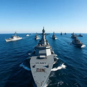
ArcGIS Maritime Innovations: The Evolution of Geographic Information Systems for Professional Nautical Use
ArcGIS Maritime, the specialized solution for the maritime sector offered by Esri, the global leader in Geographic Information Systems (GIS) technology, has recently announced groundbreaking new capabilities. These new features represent a significant milestone in hydrographic data management, enabling the production of nautical charts compliant with the S-100 standard. This advancement not only enhances the accuracy and timeliness of nautical charts but also streamlines spatial information management, a crucial aspect for modern navigation.
The S-100 standard is an international specification developed to enhance interoperability among different information systems in the maritime domain. By adopting this standard, ArcGIS Maritime positions itself at the forefront of GIS technology, facilitating the efficient handling of complex spatial data. Maritime organizations can seamlessly integrate their information into GIS, providing a significant advantage for the planning and execution of safe and efficient nautical routes.
- Improved accuracy and timeliness of nautical charts
- Enhanced interoperability between systems
- Opportunity for training and specialization for industry professionals
The ability to handle multiple data formats guarantees flexibility, translating into safer and more efficient maritime operations. For institutions already using S-57 and S-101 specifications, the capability to generate both types of nautical charts will provide a competitive edge in terms of updating and technological compatibility.
Practical Benefits for the Maritime Sector
The implementation of these advanced capabilities in ArcGIS Maritime is highly relevant for merchant marine professionals and sailors, offering multiple benefits. Firstly, the use of updated standards improves the accuracy of nautical charts, an essential element for safe navigation. Precise and up-to-date charts help prevent accidents and optimize routes, resulting in substantial time and resource savings.
Secondly, these improvements facilitate interoperability between systems, a critical need in an increasingly digital world. With the ability to handle complex and updated hydrographic data, organizations can integrate their information with other management systems, enhancing their responsiveness to changes in the maritime environment.
Finally, the advancements in ArcGIS Maritime present an opportunity for training and specialization for industry professionals. Mastery of advanced GIS tools becomes a valuable and in-demand skill, increasing job opportunities for those with expertise in this area. Companies in the sector could greatly benefit from having experts who can maximize the potential of these technologies.
- Improved operational performance
- Increased market value for adopting companies
- Enhanced data analysis crucial for strategic decision-making
Impact on Maritime Investment and Technology
From the perspective of maritime investors, these innovations represent a window of opportunity in a sector that shows growth potential supported by digitalization and technological modernization. Investment in advanced GIS technologies not only improves operational performance but also increases the market value of companies that adopt these tools.
Furthermore, these capabilities allow sector companies to enhance their data analysis, crucial for strategic decision-making. The ability to analyze and visualize large volumes of spatial and temporal data makes the use of ArcGIS Maritime a powerful tool for developing new maritime routes, optimizing ship traffic, and improving port logistics.
Consequently, investing in this type of technology not only results in operational benefits but also drives innovation within the industry, positioning both emerging and established companies at the forefront of maritime technology.
Conclusions and Future Opportunities
In summary, the new capabilities of ArcGIS Maritime represent a transformation in the management and use of hydrographic data within the maritime sector. Their implementation not only improves navigation accuracy and safety but also opens up a range of opportunities for professionals and investors through the adoption of modern and efficient standards.
For nautical professionals, this advancement means being better prepared to face the challenges of the globalized maritime environment, while for investors, it represents an opportunity to capitalize on cutting-edge technology. By adopting these innovations, a competitive position is ensured in an evolving sector.
Finally, maritime industry professionals are encouraged to explore more about ArcGIS Maritime and consider submitting their resumes to organizations that embrace technological modernization. The adaptation and knowledge of these tools will not only enrich their skills but also increase their value in the competitive maritime job market.