- Daily transits in the Strait of Hormuz have collapsed 94.2%, from 120 to only 6.9 since 28 February.
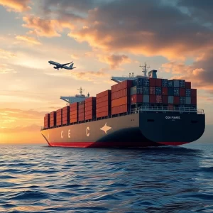
- Crude oil exports west of Hormuz plummeted 87%, from 20.1 to 2.7 million barrels per day.
- Fujairah, a key bunkering hub, is functionally offline after drone attacks, driving fuel prices to record highs.
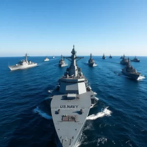
A conflict in the Persian Gulf has triggered a severe disruption in global shipping, with daily vessel transits through the Strait of Hormuz falling 94.2% since 28 February. This critical chokepoint, handling around 20% of the world’s energy shipments including oil and LNG, now operates under a selective permit system, crippling flows and forcing rapid operational changes.
Context and Background
The Strait of Hormuz is a vital maritime chokepoint, historically averaging 120 daily transits for energy carriers. Before the conflict, commercial activity in the Arabian Gulf was growing, with port calls increasing by 8.2% from January to February 2026. Regional tensions have previously altered shipping routes, but never with such an abrupt and sustained reduction.
In-Depth Technical Analysis
The 94.2% decline in transits is not just due to vessels switching off their AIS (Automatic Identification System, a tracking system for ships). Remote sensing intelligence confirms an 84.4% physical reduction in large vessels present, indicating an evacuation of the corridor. This shows shipping companies prioritise safety over efficiency, relocating fleets to safer zones.
An emerging permit system now allows only allied vessels to transit, using Iranian territorial waters instead of international lanes. For example, between 15 and 16 March, five bulk carriers (ships designed for dry cargo like grains or ore) exited the Gulf close to the Iranian coast after calling at Imam Khomeini port. This model creates a narrow but resilient channel for Iranian exports.
Concrete Operational Implications
Operationally, vessels no longer use anchoring zones as stable areas. Anchoring duration has fallen by 78.6%, with ships repositioning tactically to minimise risks. Ports such as Ras Laffan, the world’s largest LNG export centre, have halted production after an attack, while Yanbu in Saudi Arabia sees increased activity, with 57 VLCCs (Very Large Crude Carriers, oil tankers over 200,000 dwt) heading there.
GPS jamming distorts AIS signals, causing transmissions from the northern Gulf to appear in the south, such as near the United Arab Emirates. This requires corroboration with SAR (Synthetic Aperture Radar) and EO (Earth Observation) for accurate locations, increasing logistical complexity.
Impact on the Labour Market
For maritime professionals, this disruption creates demand in specialised roles. Navigation officers need training in alternative navigation methods without GPS, and maritime intelligence analysts are crucial for interpreting AIS data in disrupted environments. Moreover, operators in secure ports like Yanbu or Port Rashid may see more opportunities, while in high-risk areas like the Iranian Gulf, labour activity declines.
Macro Context
Geopolitically, the conflict has split the energy market. Conventional Gulf exports are paralysed, while Iran maintains flows through its infrastructure, such as the Goreh-Jask pipeline. From a regulatory perspective, this could spur global rules for resilience at chokepoints, though currently, self-protection by shipping firms prevails.
Outlook
In the short term, bunker prices are expected to remain high with Fujairah out of service. If the permit system persists, shipowners might redesign routes to avoid the Gulf, increasing costs and transit times. Long-term, this could accelerate investments in alternative fuels and interference-resistant navigation technologies.
FAQ
- What is a permit system in the maritime context? It is a model where only authorised vessels, typically for political or security reasons, can transit a zone. In this case, Iran allows passage through its territorial waters to pre-approved ships, creating an exclusive channel while the strait remains closed to the global fleet.
- How does GPS jamming affect maritime safety? Jamming interferes with positioning signals, causing errors in AIS data that show vessels in incorrect locations. This complicates navigation, raises collision risks, and requires the use of complementary technologies like radar or satellites to maintain operational safety.
- What does the 87% drop in crude exports west of Hormuz imply? It means most Gulf oil is trapped within the region, reducing global supply and pushing up prices. This forces importers to seek alternative sources, while local producers like Saudi Arabia divert exports to safer ports such as Yanbu.
Editorial Note: This article has been professionally adapted from Spanish to British English
for the WishToSail.com international maritime audience. Original article published at
QuieroNavegar.app.